
To map your canoe route like a pro, learn to interpret waterway symbols, water depths, hazards, and campsites on your map. Use traditional maps alongside GPS or smartphone apps for real-time updates, but don’t rely solely on technology—understand topographic contours and waterway markings for safety. Practice plotting routes and recognizing symbols to navigate confidently through changing conditions. Continue exploring, and you’ll gain the skills needed to plan safe, efficient paddling trips with ease.
Key Takeaways
- Familiarize yourself with map symbols for water depths, hazards, and landmarks to interpret routes accurately.
- Cross-reference traditional maps with GPS or digital apps for comprehensive navigation and confirmation.
- Practice plotting routes and identifying waterway features to build confidence and adaptability.
- Study topographic contours and waterway markings to anticipate terrain and water conditions.
- Regularly verify your position using landmarks or water features to ensure safe navigation.
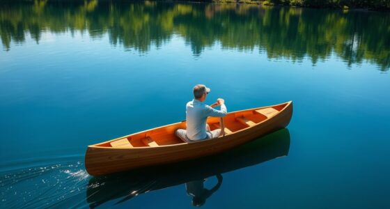
Canoe cartography combines the art of mapmaking with the practical needs of paddlers, helping you navigate waterways with confidence. When you’re out on the water, understanding how to read and interpret maps becomes essential. Map symbols are the visual language of your navigation tools, representing everything from water depths to hazards, campsites, and current directions. Familiarizing yourself with these symbols allows you to quickly grasp critical information at a glance, making your trip safer and more enjoyable. Whether you’re planning a day trip or an extended expedition, knowing what each symbol means helps you make smarter decisions, avoid obstacles, and find your way even when visibility is poor.
Canoe cartography helps paddlers navigate safely by understanding map symbols and waterway features.
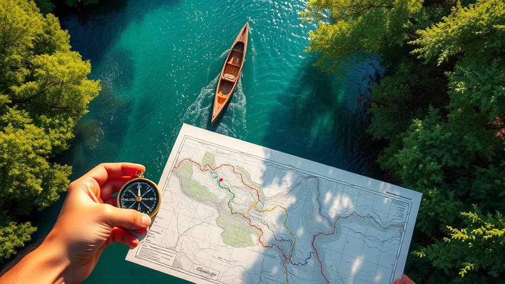
Your navigation tools go beyond simple paper maps. Modern paddlers often combine traditional maps with electronic devices like GPS units and smartphones equipped with mapping apps. These tools can provide real-time updates, route tracking, and even emergency location services. However, understanding how to read map symbols remains fundamental, especially if technology fails or you’re in an area with limited signal. Learning to interpret topographic contours, waterway markings, and other symbols ensures you can navigate confidently, regardless of the tools at your disposal. You should also know how to use a compass in conjunction with your map, aligning your orientation with landmarks or water features to maintain a steady course.
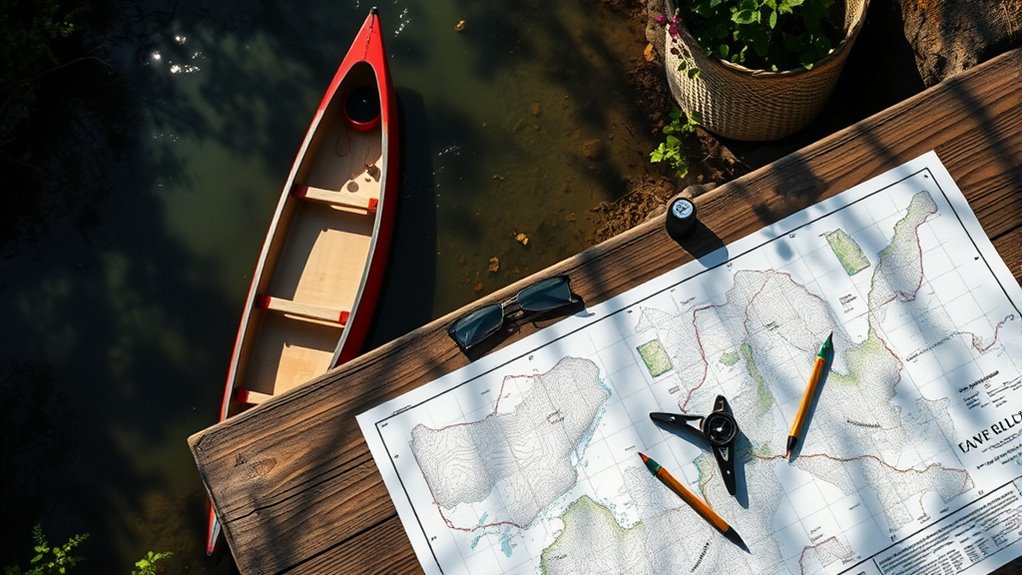
When you’re planning your route, start by studying the map thoroughly. Identify key features such as rapids, waterfalls, or shallow areas marked by specific symbols. Pay attention to the legend—this is your key to deciphering map symbols accurately. Cross-reference your planned route with navigation tools like a compass or digital app, confirming your position regularly. Marking your route on the map with a pencil or digital track helps you stay oriented and provides a reference if you need to backtrack or adjust your course.
Practicing map reading skills before hitting the water will boost your confidence. Set up exercises where you identify symbols and plot routes based on your understanding. As you become more familiar with map symbols and how to use your navigation tools effectively, you’ll find it easier to adapt to changing conditions on the water. Remember, good canoe cartography isn’t just about following a line on a map; it’s about understanding the landscape and waterway features so you can navigate safely and efficiently. With these skills, you’ll be ready to explore new waterways and enjoy your paddling adventures with peace of mind.

Land Nav Kit with Lensatic Compass, Protractor, Pace Counter & Map Markers
FIELD READY – Crush your next land navigation course with The Land Nav Kit designed specifically for the…
As an affiliate, we earn on qualifying purchases.
As an affiliate, we earn on qualifying purchases.
Frequently Asked Questions
What Are the Best Tools for Digital Canoe Route Mapping?
When choosing tools for digital canoe route mapping, you want software that offers precise digital mapping capabilities and seamless GPS integration. Programs like Gaia GPS, Google Earth, and AllTrails provide detailed terrain views and real-time GPS data, helping you plan safe and efficient routes. You can easily customize your maps, mark waypoints, and track your progress, making your paddling adventures more organized and enjoyable.
How Do Weather Conditions Affect Canoe Route Planning?
Imagine the weather as a mischievous guide, constantly shifting your plans. Weather impact is vital in route planning because seasonal variability can turn calm waters into treacherous currents or fog into invisible obstacles. You must check forecasts regularly, consider wind, rain, and temperature, and adapt your route accordingly. By doing so, you guarantee safety and enjoyment, making weather your ally rather than an unpredictable foe on your paddling adventure.
Can I Integrate GPS Data With Traditional Map Techniques?
You can definitely integrate GPS data with traditional mapping techniques to enhance your navigation. By overlaying GPS waypoints onto paper maps, you get real-time accuracy and a better sense of your position. This combination, known as GPS integration, allows you to rely on digital precision while maintaining traditional mapping skills. It’s a smart way to guarantee safety and confidence on your canoe route, especially in unfamiliar or challenging waters.
What Safety Considerations Should I Keep in Mind During Mapping?
When mapping your route, you should prioritize water safety and emergency preparedness. Always check weather conditions and water levels before heading out. Carry a first aid kit, communication devices, and extra supplies. Make sure someone knows your plan and expected return time. Staying alert to potential hazards and having a safety plan in place helps you navigate confidently, ensuring a safe and enjoyable adventure on the water.
How Do I Update My Maps With New Route Information?
Think of your map like a living river, constantly flowing and changing. To keep it current, you should employ effective map update strategies, such as noting new landmarks or hazards. Use route revision techniques like marking detours or shortcuts, and regularly cross-reference your GPS data or field notes. This way, your map remains a reliable guide, helping you navigate confidently through ever-evolving waterways.
waterway symbols and water depth maps for paddling
As an affiliate, we earn on qualifying purchases.
As an affiliate, we earn on qualifying purchases.
Conclusion
Now that you’ve mastered canoe cartography, your journey becomes a dance with the water, each stroke guided by your map’s secrets. Like a seasoned sailor steering unseen currents, you’ll chart courses with confidence and grace. Every bend and ripple transforms into a story, your route a tapestry woven with skill and adventure. So paddle on, explorer—your map is your compass, and the open water awaits your next masterpiece of discovery.

9" GPS Navigator for Car Truck RV, GPS Navigation System with 2026 Maps Free Lifetime Updates, Custom Truck Routing, Speed Camera Alerts, Day/Night Mode (Blue)
【2026 Lifetime Free Map Updates】This premium car GPS comes preloaded with the latest maps for North America (United…
As an affiliate, we earn on qualifying purchases.
As an affiliate, we earn on qualifying purchases.

Quetico Map – West – Waterproof, Durable Cloth Map for Canoeing, Hiking, and Camping by True North Map Company
Navigate Quetico Park with Confidence: This detailed cloth map provides topographic coverage of Quetico’s lakes, trails, and portages,…
As an affiliate, we earn on qualifying purchases.
As an affiliate, we earn on qualifying purchases.