


Navigational aids like charts, GPS, and electronic instruments are essential for safe travels on water and in the air. Charts help you understand depths and hazards while GPS provides accurate location information and quick route adjustments. Integrating these traditional and modern tools guarantees you can navigate confidently, even if technology fails. By mastering both approaches, you enhance your navigational skills and make informed choices. There’s a lot more to uncover about how these tools work together effectively.
Key Takeaways
- Nautical charts provide essential information on water depths, hazards, and navigational markers for safe maritime navigation.
- GPS technology offers precise location tracking and enables quick route adjustments based on real-time data.
- Traditional maps and charts remain vital for manual navigation when electronic systems are unavailable or fail.
- Combining GPS with traditional skills, like celestial navigation, enhances navigation reliability and confidence.
- Effective navigation requires interpreting data from both electronic systems and traditional charts for informed decision-making.
Have you ever wondered how sailors and pilots find their way across vast oceans and skies? The answer lies in a combination of age-old techniques and cutting-edge technology. Maritime navigation has evolved dramatically over the years, but at its core, it still relies on understanding the environment and using tools to chart a course. Whether you’re navigating a small boat or flying a commercial airliner, knowing how to use navigational aids is essential for reaching your destination safely.
Navigating vast oceans and skies combines ancient techniques with modern technology, ensuring safe journeys for sailors and pilots alike.
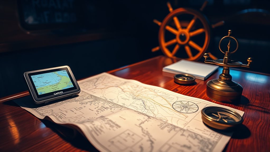
One of the most vital tools in maritime navigation is the nautical chart. These detailed maps depict various aspects of the water, such as depths, hazards, and navigational markers. When you’re out at sea, these charts act as your guide, helping you avoid obstacles and steer safely. You’ll learn to read the symbols and understand the scale, which is crucial for plotting your course. While traditional charts are still invaluable, they’re increasingly complemented by electronic instruments.
Electronic wayfinding has revolutionized how you navigate. With the advent of GPS technology, you can now pinpoint your location with incredible accuracy. A GPS receiver picks up signals from satellites orbiting the Earth, allowing you to determine your position within a few meters. This instant access to location data not only makes navigation easier but also enhances safety. You can quickly adjust your route if you encounter unexpected obstacles or changes in weather conditions. Furthermore, TikTok’s influence on trends illustrates how rapidly information and skills can spread, much like navigational techniques have evolved over time.
Combining electronic instruments with traditional navigation skills is where the magic happens. For instance, while you might rely on GPS to get a quick fix on your position, you should also know how to navigate using celestial bodies or landmarks. This dual approach ensures you can still find your way even if your electronic devices fail. It’s about striking a balance between embracing technology and respecting the foundational skills that have guided sailors and pilots for centuries.
In the cockpit or on the deck, the ability to interpret data from both traditional charts and modern electronic systems is vital. As you learn to navigate, you’ll appreciate the synergy between these methods. Understanding the principles of maritime navigation and the capabilities of electronic wayfinding will empower you to make informed decisions and navigate confidently. So, the next time you’re setting out on an adventure, remember that a mix of ancient wisdom and modern technology is your key to successful navigation.
Frequently Asked Questions
How Often Should Navigational Charts Be Updated?
You should check and update your navigational charts regularly, ideally every few months, to guarantee chart accuracy. Changes in waterways, hazards, or regulations can occur frequently, and staying informed helps maintain safety. While some charts might be updated more often, a good rule of thumb is to review them at least quarterly. This update frequency keeps you aware of any critical changes that could affect your navigation. Always prioritize safety on your journey!
Can GPS Devices Work Without Internet Access?
Yes, GPS devices can work without internet access. They rely on satellite signals to determine your location, so as long as you have a clear view of the sky, your device should function properly. Just make sure your device is compatible with the necessary satellite systems. While internet access can enhance features like real-time traffic updates, it’s not essential for basic navigation. You’ll still receive accurate positioning wherever you are!
What Are the Limitations of Electronic Navigational Instruments?
Electronic navigational instruments have several limitations. You might encounter errors in electronic navigation due to signal loss, software glitches, or inaccurate data. These devices often rely on technology, which can fail or become outdated, leaving you without reliable guidance. Additionally, they can’t replace traditional skills like map reading. If you depend solely on these tools, you risk being unprepared for situations where technology fails or isn’t available. Always have backup methods ready.
How Do I Choose the Right Chart for My Journey?
When you’re choosing the right chart for your journey, it’s important to not throw caution to the wind. First, consider scale selection; larger scales provide more detail for close navigation, while smaller scales cover broader areas. Next, familiarize yourself with chart symbols, as they convey vital information about hazards, depths, and landmarks. By understanding these aspects, you’ll guarantee a smoother sailing experience and make informed decisions along the way.
Are Paper Charts Still Relevant in Modern Navigation?
Yes, paper charts are still relevant in modern navigation. They provide a tangible reference that can enhance your understanding of traditional navigation techniques. In situations where electronic devices fail or batteries die, you’ll appreciate having paper charts as a backup. They also allow you to practice essential skills like plotting a course and understanding topography without relying solely on technology. Embracing both methods can make you a more competent navigator.
Conclusion
Navigational aids like charts, GPS, and electronic instruments are essential for safe and efficient travel on water or land. Did you know that about 90% of global trade relies on maritime shipping? That’s a staggering statistic that highlights the importance of accurate navigation. By leveraging these tools, you can guarantee you’re always on course, whether you’re sailing the seas or exploring new terrains. So, embrace technology and make your journeys smoother and more enjoyable!